
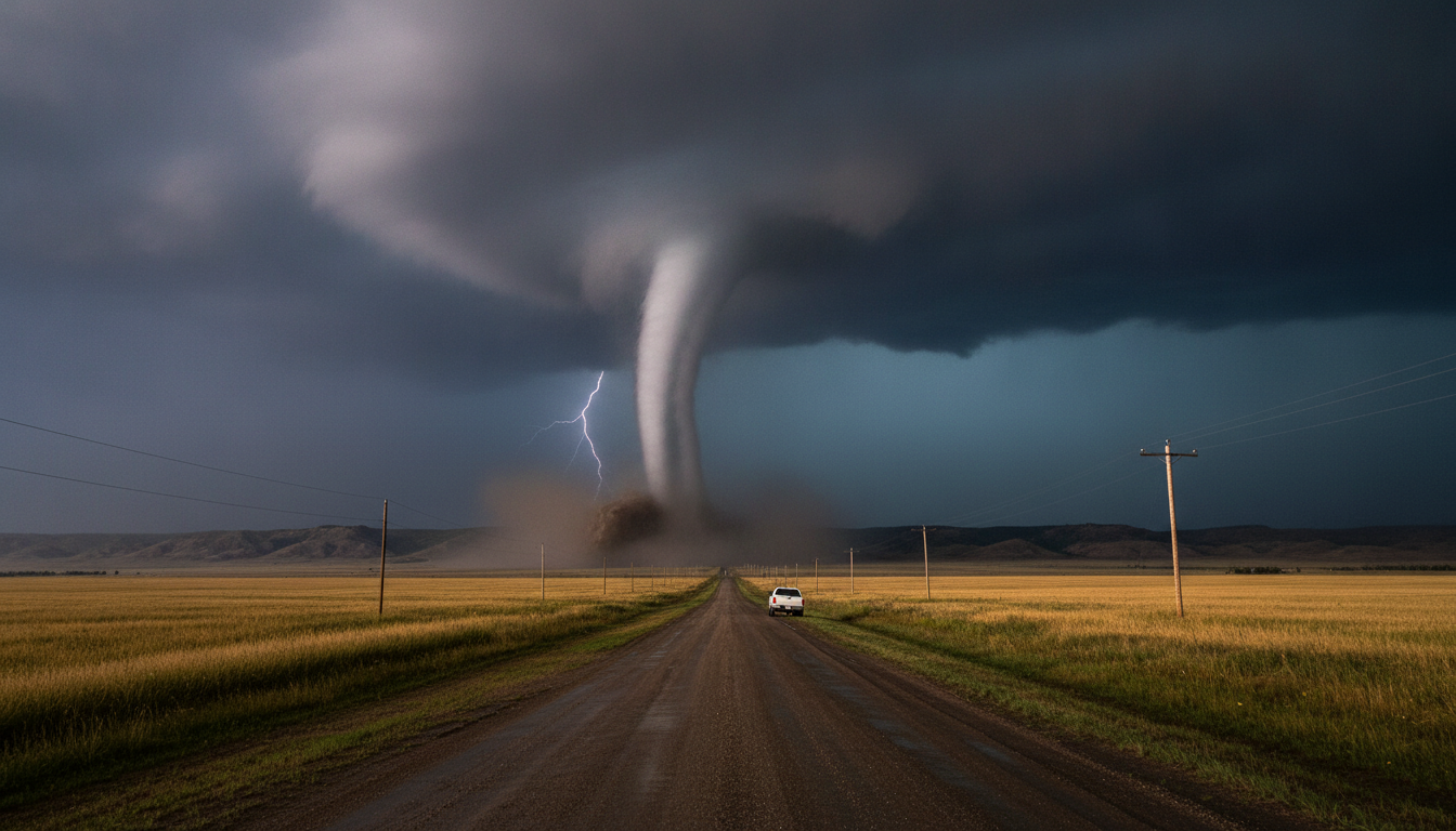
Alberta-Saskatchewan tornado touches down near Tulliby Lake amid Prairie heat and multiple twisters
A tornado near the Alberta–Saskatchewan border touched down Saturday night, prompting warnings as heat-driven storms produced multiple tornadoes across the Prairies and left communities assessing damage and emergency responses.
The tornado, reported in the Tulliby Lake area about 60 kilometres northwest of Lloydminster, prompted a red tornado warning from Environment Canada for the County of Vermilion River at around 5:30 p.m. Saturday, which was cancelled roughly 30 minutes later. Visual evidence from a local viewer showed rotation and funnel clouds on the ground, and provincial agencies have been monitoring the situation for any reports of damage or injuries.
Environment Canada confirmed the twister is the 24th reported in Alberta so far this year, a figure that represents an increase of more than 50 per cent compared with the same period last year. The same heat system spawned a record 10 tornado reports in Saskatchewan the previous day, highlighting a rapid escalation of severe weather tied to an extended heat event over southern Saskatchewan and Manitoba.
Local emergency services and municipal officials in affected areas mobilized to check for impacts, while meteorologists warned that the combination of high temperatures and moisture created conditions favourable for strong thunderstorms capable of producing tornadoes, large hail, damaging winds and intense rainfall. Heat warnings and orange-level humidex alerts remained in effect across parts of southern Saskatchewan and southern Manitoba.
Tornado touchdown and immediate warnings
The touchdown near Tulliby Lake occurred shortly after Environment Canada issued its red tornado warning for the County of Vermilion River, signalling an imminent threat to life and property. The warning was active for about half an hour before being cancelled as the immediate threat passed, but the event drew quick attention from local authorities and media outlets.
A Global News viewer captured still images and video showing a rotating column touching the ground in the Tulliby Lake area, roughly 60 kilometres northwest of Lloydminster, Alberta. Those visuals helped confirm the report in real time and aided forecasters in tracking the storm’s path as it moved through a sparsely populated rural corridor.
Municipal crews and first responders in the region reported no immediate large-scale structural damage in the hours after the warning, but officials urged residents to remain cautious and to report any downed power lines or debris. Emergency services continued patrols and welfare checks into the night to ensure vulnerable properties and residents were safe.
Environment Canada advisories and meteorologist briefings
Environment Canada issued the red tornado warning that encompassed portions of the County of Vermilion River as part of a broader set of alerts across the Prairies, and they cancelled the specific warning when the imminent tornado threat diminished. Forecasters emphasized that rapid storm development under extreme heat conditions required continuous monitoring.
Meteorologist Kayla Bilous told Global News that the storms were forming within a prolonged heat event over southern Saskatchewan and Manitoba, creating strong instability and wind shear conducive to tornado development. Bilous and other agency officials stressed that residents should heed warnings, seek shelter immediately when a tornado warning is issued, and avoid travelling during severe storm alerts.
Forecasters also warned of associated hazards such as large hail, damaging straight-line winds and locally intense downpours that can cause flash flooding. Local media and municipal emergency management teams amplified Environment Canada’s messaging to ensure rural and town residents were aware of the elevated risk.
Scale of tornado activity across Alberta and Saskatchewan
The twister near Tulliby Lake is part of an unusually active stretch of severe weather across the Canadian Prairies this week. Alberta has now recorded 24 tornado reports so far this year, marking a substantial increase from the prior year’s tally through comparable dates. Saskatchewan experienced a particularly unusual surge: meteorologists recorded 10 tornado reports on Friday alone, a rare single-day total for the province.
Researchers and operational forecasters note that while year-to-year tornado counts vary widely, clusters of tornado reports often align with prolonged heat and moisture surges that provide the necessary fuel for supercell thunderstorms. The current pattern — a combination of elevated temperatures, humid air masses and strong upper-level dynamics — has sharpened the risk of multiple, sometimes simultaneous severe convective storms.
Provincial weather services in Alberta and Saskatchewan are compiling reports, witness accounts and damage assessments to confirm tornado paths and intensities. Those assessments will inform any post-event messaging about building resilience and possible improvements to public warning systems in rural areas where tornadoes can cross open agricultural land and occasionally impact small communities.
Heat warnings and humidex extremes feeding storms
The series of tornadoes and thunderstorms this week coincided with a prolonged heat event that prompted Environment Canada to issue heat warnings across extensive parts of southern Saskatchewan and Manitoba. In sections of southeastern Saskatchewan and southern Manitoba, orange-level heat warnings indicated humidex values expected in the mid-40s, a level that poses heat-related health risks.
Hot, humid air near the surface combined with cooler, stronger winds aloft creates atmospheric instability, a key ingredient for the explosive thunderstorm development that can spawn tornadoes. Forecasters said the heat not only directly threatened public health but also served as an energy source for convective storms capable of producing severe weather, including multiple tornadic cells in short order.
Health and municipal officials urged residents to take heat precautions, such as staying hydrated, avoiding strenuous outdoor work during peak heat hours and checking on elderly or isolated neighbours. At the same time, emergency management teams emphasized that heat-related measures must be paired with severe-weather preparedness because rapid deterioration into storms can leave little time to relocate or shelter.
Local impacts, response and community resilience
Local municipalities in the affected regions reported mostly localized impacts in the immediate aftermath of the tornado warning, with preliminary reports indicating scattered debris and minor infrastructure issues in rural areas. Power authorities were placed on alert to respond to potential outages caused by fallen trees and storm-wrecked lines as crews stood ready to assess any damage at first light.
Community emergency management teams in the County of Vermilion River and neighbouring jurisdictions coordinated welfare checks and public updates, using social media and local radio to reach residents without access to weather apps or reliable cellular service. Municipal leaders reiterated standard advice: seek sturdy shelter during tornado warnings, avoid downed electrical infrastructure and report any damage through official municipal channels.
Agencies also began collecting post-event data to feed into formal tornado verification processes, which include ground surveys, eyewitness interviews and analysis of radar and satellite imagery. That verification will help determine the tornado’s exact path, potential intensity and whether additional public infrastructure or communication strategies should be adjusted going forward.
What residents and travellers should do now
Residents in the region are advised to remain vigilant as the heat and storm system evolves, keeping an eye on Environment Canada bulletins and local emergency notices for any renewed warnings. People living in mobile homes, older houses or near treelines should identify the safest nearby shelter, such as a basement or an interior room on the lowest floor, and have an emergency kit ready.
Drivers on rural highways are urged to avoid stopping under overpasses or trees to view storms, as debris and sudden wind changes can create dangerous conditions. If a tornado is sighted while travelling, motorists should seek shelter in a substantial building if possible; if no shelter exists, lie flat in a low area away from vehicles and cover your head with your hands.
Community organizations and municipal offices recommended that residents check on elders and neighbours and ensure access to hydration and cooling spaces while continuing to monitor severe weather updates. Those with property concerns were told to document conditions with photographs and to notify insurance providers promptly about any suspected damage.
Final paragraph
As Prairie communities assess the impacts of the Alberta–Saskatchewan tornado and accompanying storms, officials emphasized the dual threats posed by extreme heat and severe convective weather, urging residents to balance heat-safety actions with immediate responses to tornado warnings and to follow Environment Canada guidance as conditions evolve.
