
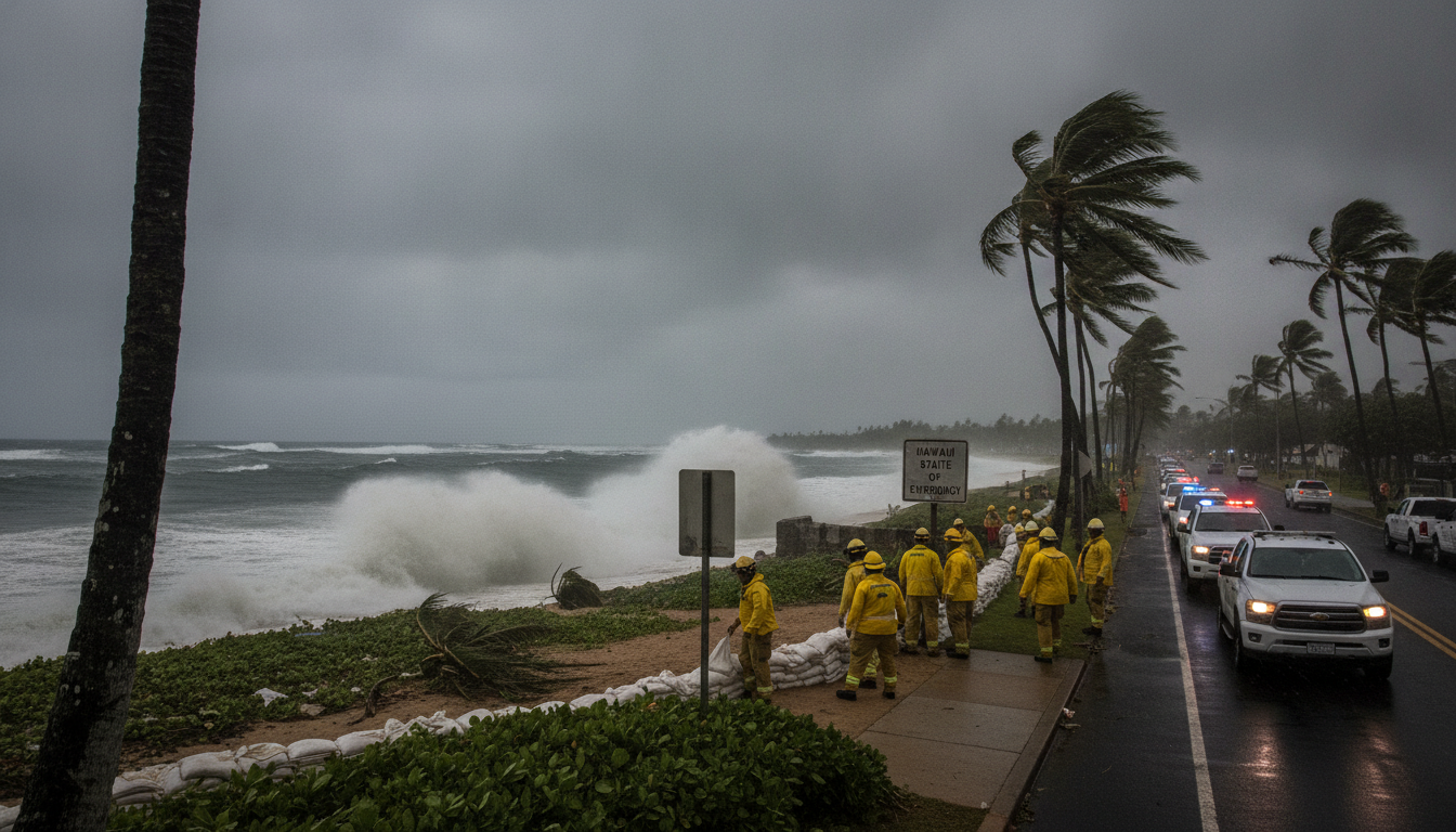
Hurricane Lala grazes Hawaii’s Big Island, bringing torrential rain and dangerous surf
Hurricane Lala grazed the southern coast of Hawaii’s Big Island on Aug. 15, 2026, bringing Category 1 winds, heavy rain and flood warnings across the state.
Hurricane Lala brushed the southern shore of Hawaii’s Big Island on Saturday, Aug. 15, 2026, as torrential rains and strong winds prompted widespread warnings and emergency preparations across the archipelago. The National Hurricane Center identified Lala as a Category 1 storm with sustained winds near 120 km/h and cautioned residents about life-threatening flooding and hazardous surf.
Hurricane Lala’s track and intensity
Lala strengthened to a Category 1 hurricane early Saturday, with maximum sustained winds reported at about 120 km/h, according to the National Hurricane Center. The storm’s eye came within roughly 48 kilometres southwest of South Point on the Big Island without making an immediate, direct landfall.
Forecasters said Lala was moving northwest late Saturday and was expected to gradually turn west and accelerate into Sunday as the core of the storm remained south of the smaller main Hawaiian islands and the easternmost northwestern islands. That forecast track raised concerns that powerful bands of rain and gusty winds would continue to affect exposed high terrain and coastal zones.
Warnings issued for all main Hawaiian islands
Tropical storm watches and warnings extended beyond the Big Island to include Maui, Molokai, Kahoolawe, Lanai, Oahu, Kauai and Niihau as authorities prepared for widespread impacts. The National Hurricane Center warned of powerful and dangerous waves along exposed shorelines, heightening the risk of coastal flooding and erosion.
Officials emphasized that even islands not in the direct path would see hazardous marine conditions and heavy surf, disrupting ferry service, small-boat operations and recreational beach activity. Local agencies urged residents to keep clear of beaches and coastal roads while officials monitored potential storm-surge threats.
Heavy rain, flood and mudslide threats on Big Island
Forecasters projected between 25 and 50 centimetres of rain across the Big Island, with isolated totals exceeding 60 centimetres in the heaviest bands. The National Hurricane Center warned that such rainfall rates could produce life‑threatening flash floods and dangerous mudslides, particularly in steep and mountainous areas of the island.
With roughly 210,000 residents, the Big Island’s mix of populated coastal communities and rugged interior slopes left certain neighbourhoods especially vulnerable to rapid runoff and debris flows. Emergency managers repeatedly cautioned that saturated soils could trigger destructive landslides where rainfall concentrates on steep terrain.
Widespread outages and coastal impacts
Strong outer bands of Lala knocked out power to tens of thousands of customers early Saturday, with PowerOutage.us reporting more than 40,000 households without electricity near 01:30 GMT. Utilities and crews began staging crews to assess downed lines, fallen trees and other infrastructure damage once winds subsided enough for safe repairs.
Coastal communities reported pounding surf and heavy surf-related erosion as swells and waves surged along exposed shorelines. The NHC and state officials warned that dangerous waves could make coastal roads impassable and put harbours at risk, complicating both evacuation efforts and emergency-response logistics.
State of emergency and mobilization of resources
Governor Josh Green declared a state of emergency on Thursday to mobilize resources and speed the deployment of response teams, equipment and supplies to the islands most at risk. In his public statement the governor called on residents to secure homes, assemble emergency kits and review family evacuation plans as officials prepared to move search-and-rescue and relief assets where needed.
Authorities said emergency shelters and support systems were being prepared, and that pre-positioned crews from state and federal partners stood ready to respond once conditions allowed. Officials underscored that hurricane impacts in Hawaii are uncommon but can be severe, citing the limited number of historical hurricane landfalls in the state.
Historical context and climate factors
Hurricane landfalls are rare in Hawaii; if Lala were to make direct landfall it would be the third hurricane to strike the U.S. Pacific territory in modern records, following Dot in 1959 and Iniki in 1992. Iniki remains the benchmark for destructive hurricane impacts in the islands, causing multiple deaths and widespread, multi-billion-dollar damage in 1992.
Meteorologists point to a strong El Niño this year warming the tropical Pacific and increasing the odds of an active cyclone season in the region. Scientists also note that long-term ocean warming tied to human-driven climate change is likely contributing to more intense storms and heavier precipitation where hurricanes develop.
Emergency managers and meteorologists reminded residents that conditions can change rapidly and urged people to follow updates from official channels. The National Hurricane Center and state emergency agencies continued to provide regular advisories as Lala progressed westward, and officials said they would adjust response efforts based on new observations and forecasts.
Residents are asked to heed evacuation orders where issued, avoid flooded roads, and report hazards to local authorities. Continued vigilance and adherence to official guidance remain crucial as crews prepare for recovery and response once the worst of Lala passes.
