
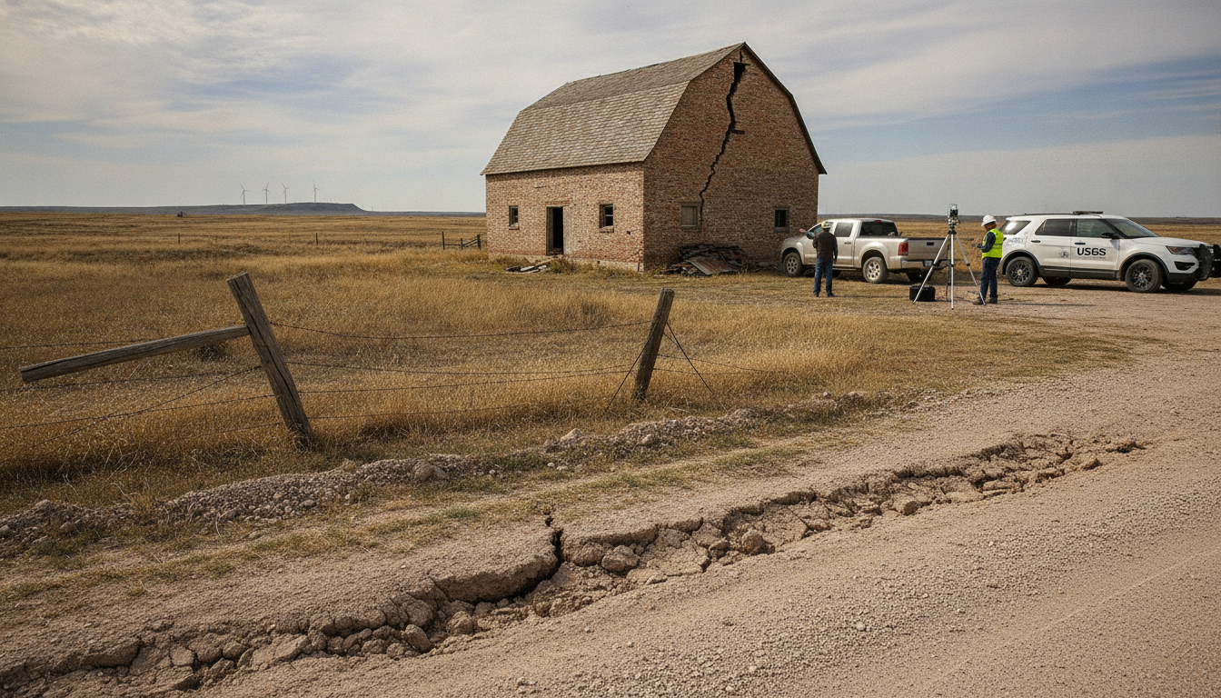
5.0 Texas earthquake strikes 60 miles northeast of Amarillo
A 5.0-magnitude Texas earthquake struck about 60 miles northeast of Amarillo on July 23, 2026, USGS reports; seismologists are reviewing data and minor shaking.
A moderately strong earthquake registered at magnitude 5.0 early Thursday morning, according to the United States Geological Survey, sending a detectable tremor through the Texas Panhandle region. The Texas earthquake was recorded at 5:21 a.m. Central time and prompted immediate review by seismic scientists monitoring the area. Officials said the initial reading was updated from an earlier estimate and that further adjustments are possible as more data are analyzed.
USGS Confirms 5.0 Magnitude Near Amarillo
The USGS placed the epicenter roughly 60 miles northeast of Amarillo, in sparsely populated parts of the Panhandle. Instrumental readings delivered the 5.0 magnitude figure after automated and manual processing at regional and national centers. The agency emphasized that magnitude estimates can change as seismologists incorporate additional recordings and refine models.
This event was strong enough to be logged on national seismic networks but occurred in an area where few major earthquakes are common. Officials noted that while the 5.0 reading is significant, the depth and local geology influence the level of shaking experienced on the surface.
Timing and Epicentre Details
Seismic data show the quake occurred at 5:21 a.m. Central time on Thursday, July 23, 2026, with the epicentre located northeast of Amarillo. Early automated reports issued by the USGS momentarily listed the magnitude lower before engineers completed routine checks. The agency’s maps of affected zones are plotted in Central time to reflect local impact.
Because the epicentre was outside densely populated urban centers, immediate reports of widespread damage were limited. Emergency dispatch records and local officials were surveying communities early in the day to assess any structural or infrastructure impacts.
Magnitude Revised From Earlier Estimate
Initial system readings briefly reported a lower magnitude of 4.4 before technicians adjusted the figure to 5.0 following further analysis. Such revisions are standard practice in seismology as networks ingest additional waveforms and cross-check station calibrations. The USGS said seismologists will continue reviewing the event and could issue further updates to the magnitude and associated parameters.
Public-facing products like shake maps and aftershock forecasts are also subject to revision as more records arrive. Analysts use both local and regional seismograph stations to refine the size, depth, and location of the rupture that produced the tremor.
Who Felt the Tremor and Shake Intensity
Shake-intensity mapping indicates that areas within a broad radius experienced detectable shaking, with weaker intensity farther from the epicentre. The USGS classifies certain lower intensity values as “weak,” but those nearer the epicentre can experience stronger ground motion capable of rattling buildings and fixtures. Residents in Amarillo and surrounding towns reported feeling the tremor, consistent with the agency’s assessments.
Local authorities urged people to report any structural damage to municipal offices so officials can prioritize inspections. Utility companies were also checking transmission lines and pipelines as a precaution given the quake’s strength and the early hour it occurred.
Aftershocks and Ongoing Monitoring
Seismologists cautioned that aftershocks are typical following an event of this size and that monitoring will continue for days to come. Standard aftershock mapping often focuses on events within about 100 miles of the initial quake and tracks seismicity for at least a week after the mainshock. The USGS maintains an active watch to update forecasts and issue public alerts if significant aftershocks occur.
Regional networks and university research groups collaborated with national agencies to analyze waveforms and to detect any smaller events that may follow. Officials said stations in the region remained operational and were feeding live data into analytical systems.
Public Safety Steps and Local Response
Local emergency management teams encouraged residents to follow routine earthquake safety guidance, check for gas leaks, and inspect homes for visible damage. Where assessments identify hazards such as unstable chimneys or cracked foundations, authorities recommended contacting licensed professionals for repairs. Schools and municipal services adjusted early-morning operations while rapid assessments were underway.
While no major injuries or widespread damage were immediately reported, responders remained on alert and coordinated with state-level agencies to ensure resources were available if needs emerged. The state emergency operations center monitored the situation and stood ready to assist local jurisdictions.
Response crews and seismologists will continue compiling and sharing information as the situation develops. Residents are advised to rely on official channels for updates and to heed any local advisories or precautionary measures.
Officials will release further details as reviews conclude and additional data arrive, and scientists noted the potential for figures to be refined in subsequent bulletins.
